A woman at a window in New York#
In 1958, Jane Jacobs watched New York City's planning commissioner, Robert Moses, drive the Cross Bronx Expressway through the middle of the most densely populated urban residential neighbourhood in the United States. Moses demolished 60,000 homes and displaced 250,000 people to lay a six-lane elevated highway through the South Bronx — not because it served the commuting patterns of South Bronx residents (few owned cars) but because it served the commuting patterns of suburban commuters driving into Manhattan from Westchester County. In Moses's planning philosophy, density itself was the problem. The slums had to be cleared. The highway was the instrument of progress.
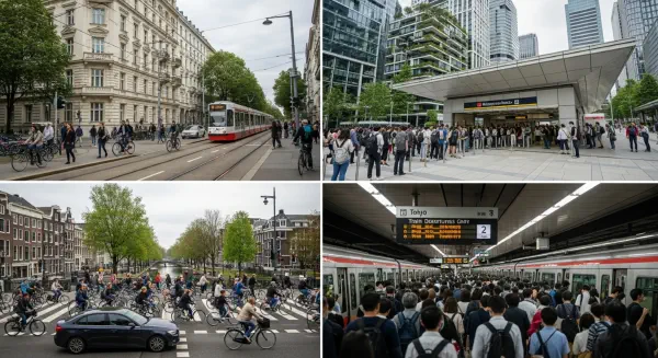
Jacobs published The Death and Life of Great American Cities three years later, in 1961. The book argued the opposite: that urban density — the close-packed mixture of old buildings and new, of residential and commercial uses, of people arriving at different hours for different purposes — was not the cause of urban pathology but the engine of urban vitality. Professional planners at the time considered her an amateur meddler with no credentials. The American Institute of Planners dismissed the book.
The argument took half a century to settle empirically. In 2014, Christopher Jones and Daniel Kammen, engineering professors at UC Berkeley, published a study in Environmental Science & Technology that used household-level consumption data — utility bills, vehicle miles travelled, air travel, food and goods spending — to calculate carbon footprints for approximately 37,000 US zip codes. The data mapped onto a map of the United States that looked, to a climate scientist, like a direct vindication of Jacobs: the lowest carbon footprints were in the densest urban cores; the highest were in the low-density suburban and exurban fringes. The margin was not slight.
Where you live is what you emit#
The Urban Carbon Leverage Factor is a comparative metric, not an average. UCLF = Per-capita transport + building heating/cooling emissions in the lowest-density urban quintile ÷ Per-capita transport + building heating/cooling emissions in the highest-density urban quintile, controlling for income and climate zone. It strips out the confounding variables — income, weather, age of housing stock — and asks a narrow question: holding everything else equal, how much more carbon does the same person emit in a low-density settlement pattern compared to a high-density one?
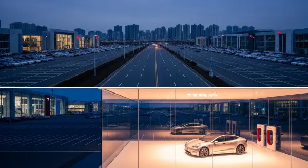
The answer, across multiple studies and metropolitan areas, is approximately 3–5. Residents of low-density US suburbs generate three to five times the transport and residential energy emissions of residents in high-density urban cores at equivalent income levels. The mechanism is not primarily about individual choices. It is about the structural constraints that different urban forms impose on transportation options and building thermal performance. In a low-density suburb, a car is not a preference — it is a physical requirement. In a high-density urban neighbourhood, it may still be owned but it is driven at a fraction of suburban annual mileage, while public transit, walking, and cycling absorb trip demand that, in the suburb, is entirely car-dependent.
The geometry of carbon#
The transport component of the UCLF operates through a mechanism that urban economists call "induced demand" and climate scientists call "structural lock-in." When land is developed at densities below approximately 3,500 housing units per square kilometre (a threshold identified empirically by Peter Newman and Jeffrey Kenworthy as the density below which bus transit becomes operationally unviable), the spatial dispersion of destinations makes walking and cycling impractical for most trips, and the passenger volumes within any corridor fall below the threshold at which even frequent bus service becomes cost-effective to operate. Below that threshold, residents' transport emissions are determined by auto dependence — which is itself a structural consequence of the built environment, not a preference revealed in a free market.
Jones and Kammen's 2014 data showed that the average carbon footprint for the highest-density urban quintile in US cities — places like central Manhattan, central San Francisco, and Chicago's Loop — was approximately 4–5 tonnes of CO₂e per capita per year for transport and home energy combined. The lowest-density suburban quintile, within the same metropolitan statistical areas, showed carbon footprints of 16–22 tonnes per capita per year for the same two categories. The UCLF for these metropolitan areas ranged from approximately 3.2 (Chicago) to 4.8 (Sacramento).
David Owen's 2009 book Green Metropolis documented the Manhattan data point that routinely surprises people encountering it for the first time: the average Manhattan resident generates approximately 7 tonnes of CO₂e per year total across all consumption categories — less than one-third of the US national average of approximately 23 tonnes per capita. Manhattan is not populated by environmentally conscious high-income individuals making deliberate low-carbon choices. It is populated by ordinary high-income individuals who happen to live at a density where owning a car is more trouble than the alternative, where apartment heating and cooling loads are shared across thousands of square metres of floor area, and where food and retail are accessible within walking distance of most residences. The structural arithmetic of density does the work that Manhattanites' individual decisions do not.
The building envelope and density#
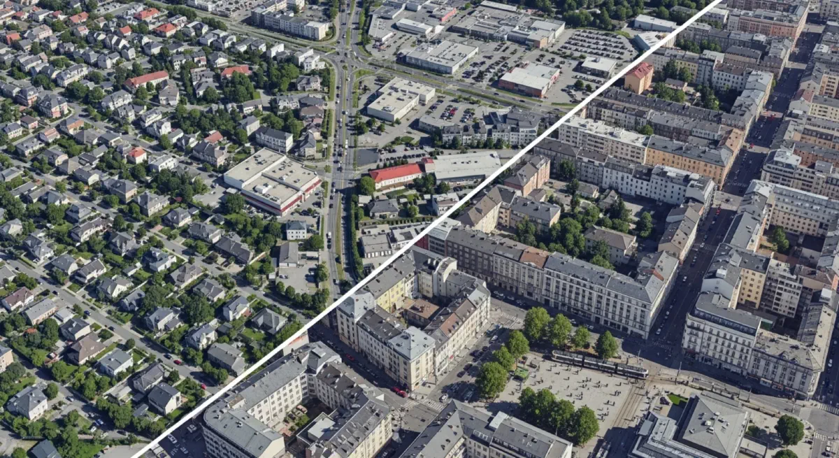
The energy component of the UCLF operates through a physical mechanism that is, if anything, more straightforward than the transport component. Heat loss from a building is a function of exposed surface area; internal volume is a function of enclosed floor area. A detached single-family home has approximately 5–6 times the external surface area per unit of floor area compared to an apartment in a midrise residential building, because detached homes expose all four walls, a roof, and in most cases a floor above a crawl space or unheated basement. This ratio is not an engineering approximation — it is Euclidean geometry. A household in a detached home in a heating-dominated climate (Chicago, Minneapolis, Toronto) faces a structural heating burden that no amount of insulation fully equalises against a comparable household in a shared-wall apartment building, because the exposed surface area per unit of floor space is fundamentally different.
The US Energy Information Administration's Residential Energy Consumption Survey (RECS) consistently finds that single-family detached homes consume approximately 2.1–2.4 times the energy per household as apartment units in multifamily buildings with five or more units, across equivalent climate zones and household sizes. Per capita, accounting for the difference in average household size, the ratio is approximately 2.0–2.5× — meaning that the building form alone contributes a multiplier factor of 2 to household energy demand before transport is considered.
The combined effect — building energy at roughly 2× and transport at roughly 3–5× — produces the UCLF range of 3–5 observed empirically in US metropolitan data.
The data that changed the conversation#
The Jones and Kammen dataset was followed by a series of studies that refined the geographic resolution and extended the analysis to European and Asian cities. A 2017 meta-analysis by Reid Ewing and Robert Cervero, updating their earlier 2001 work, synthesised findings from 70 individual studies and confirmed the central finding: a doubling of residential density within otherwise comparable urban environments reduces vehicle kilometres travelled by approximately 25–30%, with a more modest effect on freight and through-traffic. The transport correlation was robust across North American, European, and Australian study contexts.
The European data introduced an important calibration nuance: European cities with comparable densities to US suburbs — the peri-urban zones around Paris, Munich, and Milan — showed transport emissions lower than comparable US suburban areas, attributable to the higher average fuel efficiency of European vehicle fleets and the availability of at least basic rail connections to urban centres. The density-emissions relationship holds across contexts, but the coefficient varies with fuel efficiency standards, transit investment, and land-use complementarity. The United States' structural disadvantage is not that it has suburbs — Europe has suburbs too — but that US zoning patterns make mixed-use transit-accessible suburban development illegal in most jurisdictions, preventing the density dividend from accruing even in suburban form.
The cost you were never handed#
The suburb came with a price tag attached. The tag was just never handed to the individual buyer. When a family purchased a 1955 Levittown house forty-five minutes from their employer by car, they received the house's price in their mortgage. They did not receive a bill for the future road maintenance costs of the access network the county would have to maintain; the energy infrastructure the utility would extend on subsidised terms; the air quality consequences of the traffic the settlement pattern generated; or the carbon the building and transport system would emit over its useful life. Those costs were distributed across other taxpayers, deferred to future maintenance budgets, or externalised onto the atmosphere.
The UCLF reveals that cost as a carbon multip lier. The 1955 Levittown house was not three to five times more carbon-intensive than an equivalent Manhattan apartment because its occupants were three to five times less concerned about emissions. It was three to five times more carbon-intensive because the structural geometry of the settlement pattern — the spatial separation of uses, the absence of transit viability, the single-family building envelope — generated a carbon obligation that preceded any individual choice by decades.
The next post examines how that obligation was constructed, who built it, and why it was built using instruments that were, in retrospect, straightforward policy mechanisms deployed in a particular direction. If policy built the suburban carbon obligation, policy can rebuild urban form in another direction. The question is whether the political economy of American city-building permits that reorientation — and what the climate cost of delay actually is.