The Agreement Nobody Was Supposed to See#
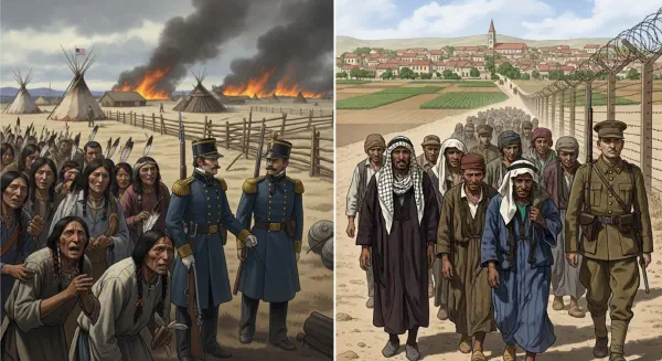
In May 1916, British diplomat Sir Mark Sykes and his French counterpart François Georges-Picot completed a secret agreement that would determine the fate of the modern Middle East for a century. Sykes had navigated its terms with a characteristic gesture, drawing his finger across a map from the ’e’ in Acre on the Mediterranean coast to the last ‘k’ in Kirkuk, on the edge of what would become Iraq. Everything above that line went to Russia; French influence ran south to the Syrian interior; British control extended over Mesopotamia and the Palestinian coast. The agreement was never announced publicly. Its existence was revealed only after the Russian Revolution of 1917, when the Bolsheviks published the Tsar’s secret wartime treaties as an act of revolutionary exposure.
The Arab reaction to the disclosure was one of profound and enduring betrayal. Britain had simultaneously been negotiating with Sherif Hussein of Mecca, promising Arab independence across the former Ottoman territories in exchange for an Arab revolt against Ottoman rule. The Sykes-Picot Agreement promised something entirely different. Caught between its commitments and its French ally, Britain chose its ally. The rest is a century of cascading conflict.
States Without Peoples, Peoples Without States#
The argument made here is not that religion is irrelevant to the Middle East’s violent political landscape — it is not. The schism between Sunni and Shia Islam, which traces to the succession dispute following the Prophet Muhammad’s death in 632 CE, is a genuine, ancient, and profound division. But Sykes and Picot imposed European nation-state logic on a region that had organised itself for centuries along entirely different principles: tribal confederacies, sectarian communities, trade route networks, and — critically — terrain that mapped onto none of the administrative divisions a European diplomat would reach for.
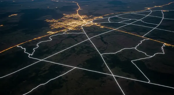
The European nation-state model assumed that sovereignty required a clearly delimited territory containing a reasonably coherent population. In the Middle East, populations had been distributed for centuries according to the logic of trade, pilgrimage routes, seasonal grazing, and the strategic geography of desert and mountain. Sunni merchant communities dominated flat, accessible commercial corridors. Alawites, Druze, and Maronites had retreated to mountain terrain that offered defensibility against majority persecution. Shia populations concentrated in river deltas and oilfields. None of these patterns mapped cleanly onto the rectangles and straight lines that a French or British cartographer would draw. Sykes-Picot attempted to force this complex human geography into neat administrative boxes. The boxes have been breaking ever since.
The Mechanism of Imposed Statehood#
Iraq is the most instructive case study in what happens when incompatible geographic and demographic units are forced into a single state. The country the British Mandate created combined three former Ottoman provinces: Mosul in the north (predominantly Kurdish and Sunni Arab, with Turkmen minorities), Baghdad in the centre (predominantly Sunni Arab), and Basra in the south (predominantly Shia Arab). These three provinces had distinct administrative traditions, different sectarian identities, and different economic orientations centuries old. Mosul looked north and east, toward Turkey and Iran. Basra looked south, toward the Persian Gulf and the Indian Ocean trade. Baghdad had always functioned as a regional capital — but a capital of empire, accountable to a distant sovereign, not a capital of a nation accountable to itself.
The British assembled Iraq from these three units for a straightforward commercial reason: oil was distributed across all of them, and a unified mandate was easier to administer than three separate territories requiring three separate dealing structures. The result was not a state but a structural contradiction — three populations forced to share a government for which none had voted and toward which none felt primary loyalty. The Hashemite monarchy Britain installed to rule this construction lasted until 1958, when it was overthrown in a military coup. Iraq has experienced an average of one fundamental political crisis or regime change per decade since independence. The 2003 invasion and its aftermath were not an aberration of that trajectory; they were its logical continuation.
Sectarian Geography Against Imposed Lines#
Marshall makes a precise geographic observation in Prisoners of Geography that illuminates the entire Syrian crisis: the country’s geography contains the seeds of its dissolution. The Alawite minority — the sect to which President Bashar al-Assad belongs, comprising roughly 12% of Syria’s population — is concentrated in the mountainous coastal region around Latakia. The Sunni majority inhabits the interior plains and the major cities of Damascus, Aleppo, Homs, and Hama. The Kurds hold the northeast. These concentrations are not ethnic accidents. They are the documented residue of centuries during which communities sought terrain aligned with their need for defensible ground, fertile agriculture, or commercial access.
The Syrian civil war that erupted in 2011 did not follow the lines Sykes and Picot had drawn in 1916. It followed the contours of the landscape beneath them. The Assad government retreated to its Alawite coastal mountain stronghold when the urban uprisings threatened his holds on the interior cities. The Islamic State carved out its territorial caliphate across the Sunni demographic plains of eastern Syria and western Iraq — territory that corresponds almost precisely to the Sunni population distribution in both countries, straddling the Sykes-Picot border as if it were not there, because for the communities living along it, it effectively was not. The Kurdish forces secured the northeast, adjacent to the Kurdish-majority regions of Iraqi Kurdistan and southeastern Turkey.
The war, in other words, was the underlying map reasserting itself against the imposed one — the geographic and sectarian logic that Sykes-Picot had suppressed finally breaking through the administrative fiction layered on top of it.
Legitimacy Built on Sand#
Lebanon represents the sharpest illustration of the Sykes-Picot system’s internal fragility. Created in 1920 as a French Mandate, it was designed to provide the Maronite Christian community with a Mediterranean homeland that was economically viable rather than geographically coherent. The French drew its borders to include sufficient territory for commercial sustainability, which meant including enough Shia and Sunni Muslims to give the Maronites a demographic majority — but only by a margin, not by an overwhelming proportion.
By the 1970s, demographic change had eroded that majority. The political system based on 1932 census data was governing a country whose population distribution it no longer reflected. The result was a civil war running from 1975 to 1990 that killed 150,000 people and displaced one million more. It ended not with a renegotiated geography but with a power-sharing formula — the Ta’if Agreement — that distributed government positions across sectarian communities according to a fixed ratio. Lebanon has functioned in a state of managed fragility ever since, its 2019 economic collapse and the 2020 Beirut port explosion both traceable, in part, to a governing structure that geography never intended to support.
The Invoice Accumulates#
The Middle East in 2026 still follows the broad outlines of Sykes-Picot, with violent modifications: the creation of Israel in 1948, the Kurdish autonomous region in northern Iraq carved out after the 1991 Gulf War, the de facto partition of Syria along territorial control lines. Every revision has come through violence. None has produced lasting stability. Marshall argues in Divided that the Middle East presents an especially acute form of the wall phenomenon — not just physical barriers but cognitive fortifications, the certainties of religious identity stacked upon the injustices of colonial cartography.
Every wall in the region — the Israeli West Bank barrier, the earthen berms dividing Syrian territory between competing militias, the fortified border between Iraq and Iran — is simultaneously a response to immediate security pressure and a monument to a map drawn by two men who had never spent a night in the region they divided. The Sykes-Picot Agreement was eventually declassified. The violence it licensed was never contained.