A Prison Without Bars#
Vladimir Putin, according to journalist and author Tim Marshall, goes to bed each night asking God why He did not put mountains in Ukraine. It is a wry observation, but it is also a precise one. The North European Plain — the vast, flat corridor stretching from France to the Ural Mountains — offers no natural barrier between Russia’s heartland and the armies of Western Europe. Every major invasion of Russia in modern history has come across it: Napoleon in 1812, the Kaiser’s forces in 1914, Hitler’s Wehrmacht in 1941. Putin has not invented a new paranoia. He has inherited an ancient one, baked into the landscape itself.
This is the central argument of Marshall’s Prisoners of Geography: leaders, however powerful, always work within constraints set not by ideology or ambition alone, but by the physical world beneath their feet. Mountains channel armies. Rivers define trade. Deserts empty borders. Coastlines create navies or deny them. The landscape is not the backdrop to history — it is history’s first author.
Before examining what happened when colonial powers ignored these rules, we must understand what the rules actually say. The story of bad borders begins not with diplomats but with terrain.
Geography Is Not Destiny — It Is Pressure#
Geography narrows the set of rational choices available to any leader attempting to defend territory, project power, or build a coherent state. The argument is not deterministic — humans adapt, technologies shift — but the underlying terrain changes on geological timescales, not political ones. What was true for Alexander the Great at the Khyber Pass is still true for NATO logistics planners in 2026.
This foundational constraint is what colonial cartographers disregarded when they drew borders across Asia and Africa in the 19th and 20th centuries. They did not merely ignore culture or ethnicity. They ignored physics. And the fractures they created have been widening ever since.
Where the Land Commands#
The Architecture of Defensible Power#
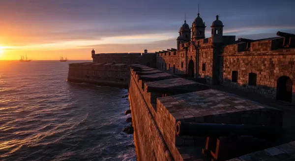
The physics of terrain are unforgiving. Russia’s geography makes this brutally clear. To its west, the North European Plain offers no natural defensive line until the Urals, roughly 1,000 miles inland. Russia has responded to this reality not with diplomacy but with distance — expanding its territorial buffer zone repeatedly across the centuries. The seizure of the Baltic states after 1940, the construction of the Soviet satellite buffer in Eastern Europe after 1945, and the annexation of Crimea in 2014 are not aberrations of Russian character. They are rational responses to indefensible flatland, expressions of a strategic logic the geography has imposed on every Russian ruler since Ivan the Terrible.
Compare this to Western Europe, where the Alps, Pyrenees, and Rhine created natural divisions that, counterintuitively, enabled cooperation. Separated by defensible borders, Western European states developed internal stability faster than regions where territorial ambiguity invited constant contest. The Rhine has not been a military frontier since 1945, but its psychological weight — as a marker of cultural and political difference — remains embedded in the continent’s architecture. Crucially, the same geography also enabled prosperity: France, the Netherlands, and Germany became wealthy not despite their terrain but through it, their flat, connected interior lowlands making large-scale agriculture and river trade possible long before the modern state existed.
The point is not that good geography guarantees good governance. It is that geography sets the terms within which governance must operate. Where political borders match geographic logic, the state expends less energy maintaining itself. Where they contradict it, the state must substitute coercion for coherence — and coercion, as the 20th century demonstrated repeatedly, is not sustainable.
The River as the Original Road#
Navigable rivers have done more to shape civilisation than any general or ideologue. In Europe, the Rhine, Elbe, Seine, and Danube created an internal network of trade long before roads made land movement efficient. Goods, ideas, and people flowed along them for millennia. These river systems were, in effect, the continent’s first common market — a pre-political foundation for the economic integration that formal European institutions later formalised.
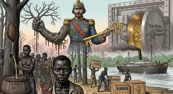
The logic extends globally. The Nile made Egypt coherent — one ribbon of agriculture in a sea of desert, stitched together by a single artery that both fed and connected the population across 1,000 miles of otherwise uninhabitable territory. The Mississippi-Missouri system helped integrate the American interior, making the United States economically viable at continental scale. The Congo basin’s river network, the most extensive in Africa, could theoretically have served the same function for central Africa. Instead, its pre-colonial trade routes were overridden when European powers drew borders that cut across watersheds rather than following them.
The principle is consistent across continents and eras: where borders follow rivers and mountain ranges, they tend to have natural stability, because they align with physical reality. Where they cut across rivers, they divide not just territory but economic systems, agricultural traditions, and the movement patterns of communities that had organised themselves around those waterways for generations.
Technology Changes the Cost; Geography Sets the Price#
Air power, satellite imagery, and precision-guided munitions have transformed military reach. The United States can strike a target in Mosul from a base in Missouri without needing a forward airstrip. Marshall acknowledges this evolution in Prisoners of Geography — technology has bent the iron rules of geography, but it has not broken them. The rules still apply; they have become more expensive to circumvent.
Afghanistan provides the clearest modern illustration. In the autumn of 2001, the most sophisticated military machine in human history sat immobile near Mazar-e-Sharif because a sandstorm had rendered satellite technology useless and made movement impossible for 36 hours. When the storm passed, the rains came, turning the ground to deep mud and delaying the advance south by a further two days. No command decision accelerated the timeline. Geography set it. The Taliban, with no air force and no satellites, had been using those same mountain passes and those same seasonal rhythms for decades — and would continue to do so after the most expensive counterinsurgency campaign in history concluded with a withdrawal in 2021.
The lesson is not that technology is irrelevant but that its advantages diminish in precisely the terrain where colonial borders were most carelessly drawn — the high mountain passes of Central and South Asia, the vast desert corridors of the Sahel, the river deltas of Southeast Asia. These are the places where the rules bite hardest, and where the fractures of artificial borders generate the most intractable conflicts.
The Cost of Ignoring the Rulebook#
Geography set the price for every border drawn without consulting it. Stable states across all eras have tended to follow terrain contours: mountain ranges as barriers, rivers as trade corridors, coastal geography as natural limits. The great pre-modern empires — Roman, Ottoman, Mughal — all struggled to hold territories where geography worked against their administrative logic and thrived where it worked with them.
European colonial powers, at the peak of 19th-century technological confidence, believed they had surpassed these ancient constraints. They had steam engines, rifled artillery, and telegraph cables. They could send an administrator to Lagos, Karachi, or Hanoi and maintain control from London or Paris. But administering an empire at distance is not the same as building a coherent state. The former requires only coercion and communication. The latter requires geography’s cooperation — the alignment of political boundaries with the physical systems along which communities naturally organise.
Coercion ended in the 20th century. Geography remained. The borders that coercive empire had made possible — lines drawn in conference rooms in Berlin, London, and Paris — were bequeathed to successor states as the permanent frame within which millions of people were expected to build nations. Many of those nations are still trying, against terrain that was never consulted, along seams that have never stopped stressing.
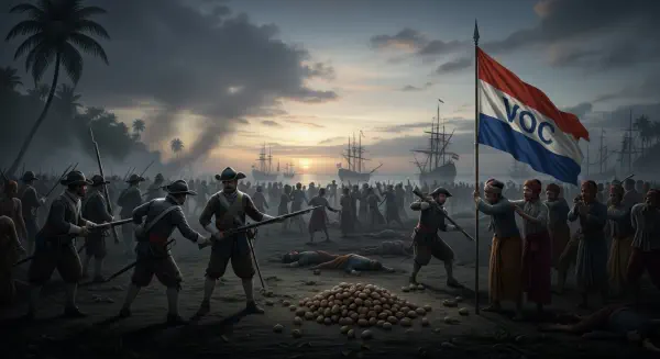
The rules geography wrote are not optional. They can be ignored, but only temporarily, and always at a compounding cost. The subsequent posts in this series examine that cost, region by region, border by border. The accounting begins in a Berlin conference room, in the winter of 1884, where the most consequential act of geographic illiteracy in modern history was given a polite name: the Scramble for Africa.