The Cartographers of Chaos: How Bad Borders Broke the World
Key Insights#
Geography is not the backdrop to political history — it is its primary author. Terrain, rivers, climate, and mountain ranges create the foundational logic of defensibility, trade, and state coherence. Political orders that align with geographic logic tend toward stability; those that contradict it tend toward structural fracture.
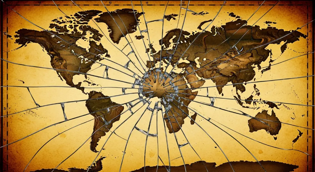
The colonial partition of the 19th and 20th centuries was the largest single act of geographic illiteracy in modern history. In Africa, Asia, and the Middle East, European powers drew borders as acts of administrative convenience, treating the physical and demographic realities of entire continents as subordinate to commercial efficiency and inter-imperial rivalry.
Straight lines are the most reliable marker of colonial violence in cartography. Approximately 44% of African borders follow lines of latitude or longitude — geometric abstractions with no relationship to rivers, mountains, watersheds, or human communities. They remain the most visible legacy of the Berlin Conference in the landscape of modern conflict.
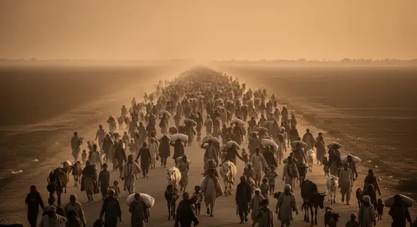
Artificial states create structural crises. Nigeria, Iraq, Lebanon, Pakistan, and the Democratic Republic of Congo are among the most consequential cases: each is a state assembled from incompatible geographic and demographic units, and each has paid for that assembly in decades of violent conflict that no subsequent governance arrangement has fully resolved.
The Himalayas demonstrate what geography-respecting borders can achieve: China and India, two nuclear powers with competing territorial claims, have not fought a major war in more than 60 years — because the terrain makes large-scale military offensive operations practically catastrophic. Radcliffe’s line, by contrast, runs through accessible Punjab terrain, and has produced three wars and a permanent nuclear standoff.
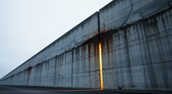
The 21st century’s wall-building epidemic is not a new crisis — it is the delayed invoice of colonial cartography. The barriers going up at India-Bangladesh, Israel-West Bank, Europe’s Schengen frontier, and the US-Mexico border all mark precisely the fault lines that colonial partition created and geopolitical inertia preserved across generations.
Digital tribalism accelerates wall-building by making geographic fault lines feel existential in real time. Social media’s amplification of in-group identity and out-group threat converts slow, structural demographic pressures into political emergencies, compressing the timeline between border stress and barrier construction to days or weeks.
Acknowledgement, not erasure, is the necessary first step. The colonial borders cannot all be redrawn — the attempt would require simultaneously managing hundreds of negotiations, many of them violent. But understanding their origin in geographic illiteracy is the prerequisite for designing the federalism, autonomy arrangements, and shared-resource frameworks that might eventually make them liveable.
References#
Marshall, T. (2015). Prisoners of geography: Ten maps that tell you everything about global politics. Elliott and Thompson.
Marshall, T. (2018). Divided: Why we’re living in an age of walls. Elliott and Thompson.
Pakenham, T. (1991). The scramble for Africa: White man’s conquest of the dark continent from 1876 to 1912. Random House.
Fromkin, D. (1989). A peace to end all peace: The fall of the Ottoman Empire and the creation of the modern Middle East. Henry Holt.
Khan, Y. (2007). The great partition: The making of India and Pakistan. Yale University Press.
Herbst, J. (2000). States and power in Africa: Comparative lessons in authority and control. Princeton University Press.
Prunier, G. (2009). Africa’s world war: Congo, the Rwandan genocide, and the making of a continental catastrophe. Oxford University Press.
Cumings, B. (2010). The Korean War: A history. Modern Library.
Atzili, B. (2012). Good fences, bad neighbors: Border fixity and international conflict. University of Chicago Press.
Fazal, T. M. (2007). State death: The politics and geography of conquest, occupation, and annexation. Princeton University Press.
Anderson, J., & O’Dowd, L. (1999). Borders, border regions and territoriality: Contradictory meanings, changing significance. Regional Studies, 33(7), 593–604. https://doi.org/10.1080/00343409950078648
Gleditsch, N. P., Wallensteen, P., Eriksson, M., Sollenberg, M., & Strand, H. (2002). Armed conflict 1946–2001: A new dataset. Journal of Peace Research, 39(5), 615–637. https://doi.org/10.1177/0022343302039005007
Zacher, M. W. (2001). The territorial integrity norm: International boundaries and the use of force. International Organization, 55(2), 215–250. https://doi.org/10.1162/00208180151140568
UNHCR. (2024). Global trends: Forced displacement in 2023. United Nations High Commissioner for Refugees.
Radcliffe, C. (1947). Reports of the Punjab and Bengal Boundary Commission. Government of India Press.